
Orion Township Neighbors by Block
Public records can establish a block’s parcel layout and its documented property history. They cannot establish every person who lives nearby. Start with the county parcel map, then check the township record layer and the recorded-document index for the individual parcels that matter. Community resources can supply a subdivision or lake name, but the township association inventory does not publish member rosters. Michigan’s voter tools also have a narrow role: MVIC is an identified-person status service, while a broader Qualified Voter File request follows state rules and excludes sensitive fields.
| Source | Block information available | Access route |
|---|---|---|
| Oakland County Property Gateway | Adjacent parcel shapes, PIN or KeyPIN, aerial context, and available map or report layers | Public map navigation and parcel clicks; report products may carry a charge |
| Orion Township BS&A | Address, name, or parcel leads for tax, utility, and building records | Public landing search; detailed screens vary by record and session |
| Oakland County Super Index | Recorded transfers, mortgages, liens, plats, and foreclosure instruments for a selected parcel | Free index search; document images or downloads are paid |
| Michigan voter resources | Individual registration or polling information, or a lawful scoped extract | MVIC lookup or a written Bureau of Elections QVF request |
| Association pages and newsletters | Subdivision, lake, civic-group name, contact route, and dated community notice | Public page or association publication; no complete roster established |
| Historical directories and maps | Earlier address-to-household clues, street context, and building or lot history | Library, archive, and map collections; exact Orion runs vary |
Use the source that matches the question. A map polygon can orient the search. A deed may explain a transfer. A directory can place a named household at an address in one edition. Each needs an independent date and parcel check before it becomes a conclusion about Orion Township neighbors.
Note: Nearby parcels may be vacant, held together, institutional, or associated with a separate mailing address, so every parcel needs its own review.
Map Orion Township Neighbors
Oakland County’s parcel layer supports map navigation and parcel selection. It does not document a confirmed radius, buffer, or export tool for a complete neighbor list. Work outward from the known parcel instead. Save each parcel’s KeyPIN, situs address, boundary, and map date before opening its records. The county describes the KeyPIN as the link between parcel geometry and land records. A displayed boundary is a map aid, not a legal survey line.
- Enter the address in Property Gateway, center the map, and click the known parcel. Record the PIN or KeyPIN and legal-description lead.
- Pan or zoom to the adjacent polygons. Click each parcel separately and preserve the displayed situs address and parcel identifier.
- Run each PIN or address through Property Gateway and BS&A. Compare owner or landowner field, tax or assessment year, mailing field, and legal description without treating any mailing field as occupancy proof.
- Use the Super Index for a dated transfer or plat lead, then confirm the instrument’s parcel description before tying it to the block.
- Switch to the Orion Township Street Directory only when the goal expands from nearby parcels to the full records chain along a named street.
The practical flow is address to parcel map, parcel identifier to property record, then recorded document or community source. Keeping those stages separate prevents a visual neighbor relationship from becoming an unsupported personal claim.
Orion Township Neighbor Parcel Search
Oakland County Property Gateway accepts a Property Address or PIN and requires at least five characters. County guidance documents partial address searches such as 1200 S and 123 S V, wildcard address forms such as 1% Main and 1% S% M, a partial PIN such as 14011%, and comma-separated multiple PINs. Those options help when an Orion Township road is abbreviated differently or a researcher has several candidate parcels. A card purchase can provide an individual report without a login, while other products and delivery choices vary.
Property Gateway’s public map and report workspace is the county source shown below.
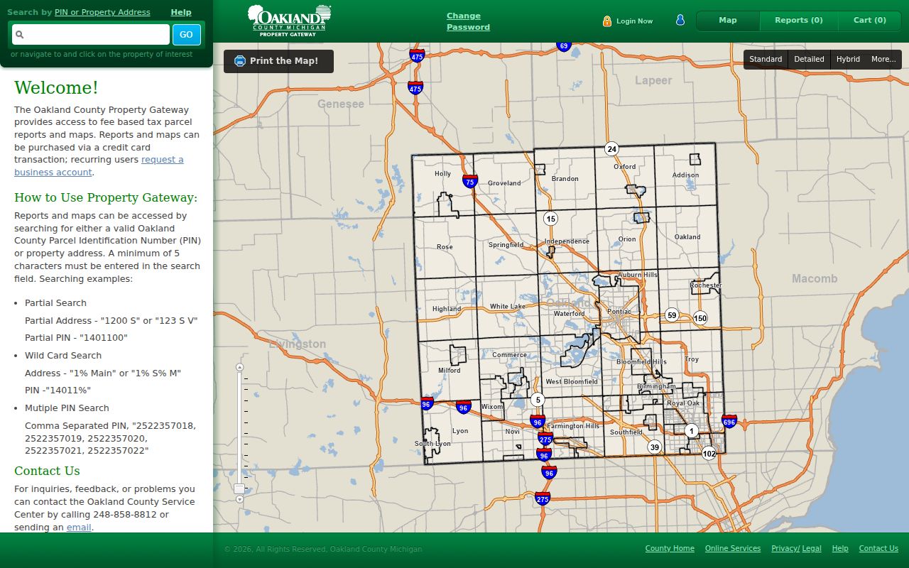
A useful capture includes the exact query, returned PIN, displayed situs, map date, and report date. Current and historic aerials, contours, FEMA flood layers, landowner or tax reports, and property maps serve different purposes, so note which product produced each block detail.
Check Orion Township Neighbor Parcels
A parcel name field is not the same thing as a resident list. The situs address identifies the taxable property location. A mailing address identifies where a notice goes and can be another property, a business, a post-office box, or an out-of-area location. The recorded deed identifies grantor and grantee parties at the time of the instrument. A historical directory may identify a household for its edition year. For Orion Township neighbors, retain those as distinct fields instead of presenting one as proof of another.
- PIN or KeyPIN
- The ten-digit parcel identifier that connects the county map geometry to property and land-record research. Dashes may be optional in the search form.
- Situs address
- The address of the property itself. It is not necessarily the location where an owner receives mail.
- Legal description
- The subdivision, lot, block, or boundary language that confirms a deed and a parcel refer to the same land.
- Recorded party
- A grantor or grantee named in an instrument. That role documents the transaction, not a complete household.
Property Gateway can show the map and report context, while Orion BS&A adds municipal tax, utility, and building-record leads. The detailed BS&A result fields were not confirmed in the research capture, so record only the fields the live result actually displays. For a date question, a permit, inspection, planning, or ZBA file may be more useful than an ownership label.
Orion Township Neighbors and Associations
The township’s official association inventory is a strong geography tool. It identifies names such as Bald Mountain Condo, Bunny Run, Creekside Village, Forest Hills, Keatington, Lake Forest, Long Lake, Orion Woods, Paint Creek Ridge #1, Stonegate West, and Villas at Parkview. Preserve spelling and numbering exactly because a subdivision or lake name can be the missing search token in an archive, newspaper, or map search. The inventory offers a way to suggest an association website, but it does not establish an umbrella organization, current activity, or a public member directory.
| Association lead | What the documented source supports | Responsible next step |
|---|---|---|
| Long Lake Property Owners Association | All-volunteer community context for a 94-acre lake, Bunny Run, Shores of Long Lake, annual newsletter, and board or contact structure | Use its own contact route or dated newsletter for local-history context |
| Keatington entries | Keatington, Keatington Cedars #1 and #2, and Keatington Woods are separate township inventory search tokens | Search the precise listed name with a road, date, and parcel identifier |
| Lake and condominium entries | Named community geography, including Lake Orion Lake Association, Lakes of Indianwood, Heather Lake estates, and Bald Mountain entries | Confirm the individual association’s current contact and publication access |
Orion Township’s homeowner association inventory is the official starting list for those community names.
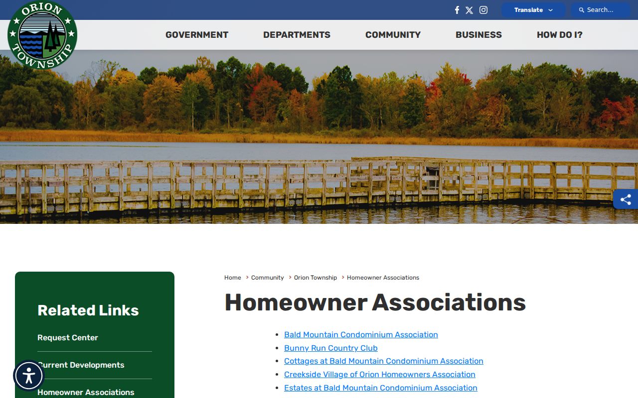
Association material can place a block within a community and point to dated notices. It should not be used to infer membership or residence when the publication does not provide that information.
Orion Township Voter Record Limits
Michigan Voter Information Center is an identified-voter service, not a street roster. Its name mode asks for first name, last name, birth month, birth year, and ZIP. It also has license and address modes for voter or polling information. Michigan law makes voter-registration records public subject to exclusions, including identification numbers, month and day of birth, phone, email, signature, and registration-decision information. Do not use a block map to turn that personal service into a census of Orion Township neighbors.
A broader Qualified Voter File request is made to the Bureau of Elections using the current request form. It can be scoped by jurisdiction, precinct, county, district, and other listed geographies, with selected public fields and delivery options. The request route is written and controlled, not a public click-through block list. For an election record held locally, contact the clerk; for statewide election documents, the research identifies the Bureau of Elections as the route. Confirm current fees and turnaround before ordering because the captured form did not state a current fee.
Note: Voter status, a parcel record, and a household relationship each answer different questions and should remain separate research notes.
Orion Township Block Change Records
Building and planning records add a dated layer around a block without identifying every neighbor. Orion’s mechanical permit form calls for street address, city, state, ZIP, owner name, owner phone, permit number, and related building-permit information. BS&A exposes Building Department Record Search and inspection or permit functions. Zoning records can include maps, amendments, variances, appeals, special land uses, certificates of occupancy, and applications. Request older files through the township’s FOIA portal or its documented email, fax, mail, in-person, written, and verbal channels, describing the existing record and time range.
For historic context, the Library of Congress has five Lake Orion Sanborn sheets dated April 1934 through March 1943. Orion Library’s History Archive, Oakland Press access, and the Oakland History Center supply newspaper, yearbook, obituary, map, and manuscript routes. Maps and notices can explain when a building, road, or community name appeared. They do not establish current residence. Orion’s reported 1835 to 1859 township-record fire makes surviving deeds, newspapers, cemetery sources, and county collections especially important for earlier block history.
Orion Township Neighbor Privacy Limits
Some facts should not be inferred or republished. Public records may not identify every household member, an occupant who is not in a property record, a protected Address Confidentiality Program participant, a utility account holder, delivery information, or restricted voter data. Michigan’s Address Confidentiality Program provides a designated address and mail forwarding for qualifying people at risk of physical harm. Never try to reverse a protected address through linked records.
| Official parcel and community records | Commercial neighbor-search tools |
|---|---|
| Show a defined source, date, property field, map context, or community publication. They still require careful reading and do not prove a complete household. | May combine records from different dates and sources. Treat any result only as an unverified lead, then confirm against the original custodian. |
| Offer office, portal, archive, or documented request channels when the online result is incomplete. | Do not rely on a broad assembled result to identify, contact, or expose people around an address. |
Lawful use. Orion Township neighbor research can support community history, civic curiosity, and personal safety awareness. Do not use any record to stalk, harass, intimidate, or expose another person.